Seminole Canyon State Park & Historic Site in 30+ Degree Temperatures
- Feb 7, 2022
- 4 min read
Kicking off 2022 with our continued quest to visit all the Parks in Texas!
What turned into canceled international trips and lockdowns during the height of COVID birthed the yearning to get out and explore, and what better places to explore than right out your front door!
So my good friend, travel buddy and fellow combat photographer Russ @rklika and I launched 2022 with a recent four day camping trip to Seminole Canyon State Park in Val Verde County, west of Comstock, Texas. And we did it while the temps were in the 20’s and 30’s. We were multilayered up during the whole trip and enjoyed steaks while huddled around the campfire keeping warm at night and occasionally visiting with neighbors who were from up north looking for warmer temperatures down south during their winter months.
Seminole Canyon is a small State Park with about 12 miles of trails that look down into the beautiful canyon. You can pretty much hike everything in three days. They do offer a guided (about eight hours) canyon hike to visit more of the rock paintings. We will be back for that.
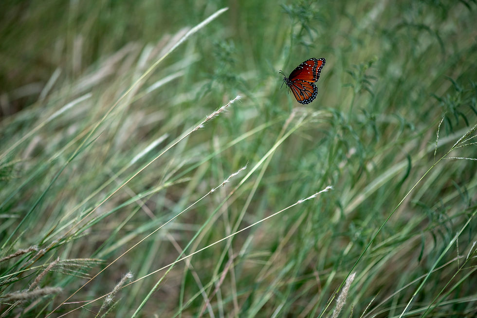
My goal for this trip was to find color in a desert environment in the middle of winter.
I do have to say that the most impressive part of this State Park was its staff of amazing rangers and volunteers that were very friendly and very knowledgable. We were even giving some incredible ranger breakfast tacos one morning to warm our spirits! Definitely ask for their famous breakfast tacos!!!! LOL
Lastly, a must do for this park is to take their guided four hour tour to one of the rock shelters nearby witnessing the history and rock paintings. Our guide was awesome and so knowledgeable. I seriously learned so much and hands down our tour was the best I have had in a long time.
I hope you enjoy the images and they inspire you do go out and explore something! Also head on over to @rklika to see his beautiful take on our trip.
Click here to see more parks we visited: Caprock Canyons State Park & Big Bend Ranch State Park, Texas
Seminole Canyon State Park
Sitting on more than 2,000 acres, displaying jagged canyons cut through the Chihuahuan Desert where the Pecos River flows into the Rio Grande. The area has been inhabited by humans for some 12,000 years, who lived in natural rock shelters carved into the canyon walls. Thousands of years later, another culture called the “Archaic people” lived in the dry rock shelters, leaving their mark on the environment through some 200 rock paintings throughout the area. The park contains some of the most outstanding examples not only in Texas but in the world. Extensive pictographs of the Lower Pecos River Style, attributed to the Middle Archaic period of 4,000 years ago, adorn rock shelters throughout its canyons.
Research into the meaning of Lower Pecos River Style murals suggests that the images may communicate important elements of the culture’s belief system, such as shamanic journeys to the land of the dead and symbolic relationships with animals and peyote a hallucinogenic cactus.
The U. S. Army was the first American presence in the Lower Pecos region. In 1851, Lieutenant Nathaniel Michler did a reconnaissance of the Rio Grande above and below its junction with the Pecos River for the United States and Mexico Boundary Commission.
After the Civil War, Lieutenant John L. Bullis and his Black Seminole Scouts operated in the area. They blasted a wagon road into the Pecos Canyon near the Rio Grande to provide the military with a shorter route between Forts Clark and Davis. The canyon is named in honor of these scouts. Sources: the internet.
#texasparks #texasstateparks #camping #exploring #igtexas #seminolecanyonstatepark #texascamping #southwestplants

Seminole Canyon on the Fate Bell pictograph site/trail.

Sotol cactus surrounded by Cenizo on the upper Canyon Rim Trail.

Seminole Canyon from the upper Canyon Rim Trail.

Sotol on the upper Canyon Rim Trail.

Dried riverbed near Panther Cave Pictograph Site on the U.S./Mexico border from the lower Canyon Rim Trail.

Small stream near Panther Cave Pictograph Site on the U.S./Mexico border from the lower Canyon Rim Trail.

Thorns from the Cylindropuntia Leptocaulis (Christmas Cholla) on the lower Canyon Rim Trail.

Trees surround a water spring on Windmill Nature Trail.

Bird nest near Desert Vista Camping Area.

Doe near Panther Cave Pictograph Site on the U.S./Mexico border from the lower Canyon Rim Trail.

U.S./Mexico border near Panther Cave Pictograph Site from the lower Canyon Rim Trail.

Mexico border across the Rio Grande River near Panther Cave Pictograph Site from the lower Canyon Rim Trail.

Natural rock shelter carved into the canyon walls near Panther Cave Pictograph Site from the lower Canyon Rim Trail.

Rock paintings on the walls of a natural rock shelter carved into the canyon on the Fate Bell pictograph site/trail.

Seminole Canyon floor on the Fate Bell pictograph site/trail.

Rock paintings on the walls of a natural rock shelter carved into the canyon on the Fate Bell pictograph site/trail.

Ocotillo on the upper Canyon Rim Trail.

Reflection of trees surrounding a water spring on Windmill Nature Trail.

Sunset from Desert Vista Camping Area.

Sunset from Desert Vista Camping Area.

The moon after sunrise from Desert Vista Camping Area.


Comments